GPS capability is advancing, but adoption is slightly behind, say GPS system designers

Sept. 16, 2010
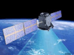
Global positioning system (GPS) technology is undergoing a transition toward better precision and efficiency through programs such as Automatic-Dependent Surveillance - Broadcast (ADS-B) and upgrades to GPS satellite programs such as Europe's Galileo and China's Compass, yet end-users are still comfortable with the current GPS products and do not see a need to change.
Posted by John McHale Global positioning system (GPS) technology is undergoing a transition toward better precision and efficiency through programs such as Automatic-Dependent Surveillance – Broadcast (ADS-B) and upgrades to GPS satellite programs such as Europe's Galileo and China's Compass, yet end-users are still comfortable with the current GPS products and do not see a need to change. Even as Galileo and Compass start to enter initial operation trials and are fielded, adoption by the at-large user base will lag slightly behind as they are quite comfortable with the capability they have now from their GPS technology, says Bob Ellis, director of commercial products and systems at Rockwell Collins in Cedar Rapids, Iowa.. "We are continuing to monitor" how these programs develop and the timing as to when the International Civil Air Transport Organization (ICAO) and others will introduce the technology for Galileo and other systems, Ellis says. When that will happen is still not clear, he adds. Once the technology is introduced, Rockwell Collins will release next-generation GPS receivers to adapt the technology, Ellis says. "In aviation, both commercial and military, safety is always the priority," says Dave Jensen, product manager, Precision Landing Systems, GNSS and Augmentations for Honeywell Aerospace. "Therefore, there is typically a lead time for technology trends to reach in-service avionics, and for air traffic operations to be optimized for the added precision. En-route GPS products have been in use for quite some time, and now the precision to do area navigation (RNAV), required navigation performance (RNP), Localizer Performance with Vertical guidance (LPV), and Precision Approaches are being developed and deployed." Space Based Augmentation Systems (SBAS), such as Wide Area Augmentation System and Local Area Augmentation System/Ground-Based Augmentation System (LAAS/GBAS) "are the current deployment technologies, and adoption in the active fleet is rising," Jensen adds. Rockwell Collins sees integrating the characteristics of other service providers by the end of the decade, he continues. ADS-B out capability will be ready by 2020, Ellis says. "On the military side, Joint Precision Approach and Landing System (JPALS) ground and airborne solutions are being developed, for production in the 2015+ timeframe," Jensen says. The U.S. Air Force GPS III upgrade will also provide a capability for commercial navigation called Level 5, which will give commercial users added frequency, Ellis says. It is forecasted to be available around 2016, he adds. It also "provides a little more tolerance for ionospheric interference," which plagues all GPS systems to one degree or another, Ellis says. The Air Force GPS provides precise timing and positioning information for military and civil users. The GPS III system, scheduled to begin launching in 2014, will provide additional signals to improve accuracy as well as anti-jamming measures crucial for the U.S. military, according to a Honeywell release. Honeywell's on board computer, reaction wheel assembly, and inertial measurement unit are used on GPS III. "Honeywell has recently received a TSO for the Integrated Navigation Receiver (INR) for the Boeing 787, which provides CAT-I GLS (LAAS or GBAS) with integrity for autolands, and the necessary performance to enable ADS-B implementation," Jensen says. "Honeywell has also certified the WAAS functionality in the KGS-200 and VIDL-G products which support the EPIC and APEX product lines, and will be first used on the Pilatus PC-12." Rockwell Collins offers the GPS-4000S sensor and associated WAAS antenna, which enables operators to utilize the GPS system without reliance on other navigation equipment for en route operations and approach procedures authorized for WAAS, such as RNAV (GPS) charts, according to a Rockwell Collins datasheet. The GPS-4000S processes the transmissions of as many as 10 GPS satellites and two SBAS geo stationary satellites simultaneously, calculating navigation solutions based on information from all satellites in view. The position, velocity, and time information are provided for incorporation into the FMS navigation function. The GLU-925from Rockwell Collins is a multi-mode receiver (MMR) certified for precision landing using either Global Navigation Satellite Systems (GNSS) or Landing Systems (ILS), according to a Rockwell Collins datasheet. The GLU-925 is the primary navigation sensor for all phases of flight, including the stringent Required Navigation Performance (RNP) requirement of 0.1 nautical miles. Future growth includes new European Galileo and U.S. L5 satellite compatibility.

Voice your opinion!

To join the conversation, and become an exclusive member of Military Aerospace, create an account today!