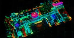
Army moves forward with project to use sensitive laser radar for wide-area mapping
RESEARCH TRIANGLE PARK, N.C., 3 Oct. 2016. U.S. Army researchers are moving forward with a project to develop super-sensitive laser radar systems for the electro-optical mapping of large areas in precise detail from high-altitude aircraft.
Officials of the Army Contracting Command in Research Triangle Park, N.C., announced an $18 million contract modification to Scitor Corp. in Reston, Va., for work involved in the High Altitude Light Detection and Ranging (LiDAR) Off-Nadir Experimentation (HALOE) project.
HALOE, which has involved the U.S. Defense Advanced Research Projects Agency (DARPA) in Arlington, Va., seeks to develop extremely sensitive LiDAR systems designed to operate from high altitudes to provide fast 3D mapping of large areas.
In remote-sensing applications like LiDAR, off-nadir refers to the ability to take accurate sensor readings of objects not directly beneath a scanner's detectors, but rather off at an angle.
The Army Contracting Command, on behalf of the Army Research Laboratory in Research Triangle Park, N.C., awarded Scitor its original $25.1 million HALOE contract in September 2014. Science Applications International Corp. (SAIC) in McLean, Va., acquired Scitor Corp. in May 2015.
Related: Why digital is flying high in aerospace and defense
The HALOE project aims at providing unprecedented access to high-resolution 3D geospatial data. Under the aegis of DARPA, HALOE technology first was deployed to Afghanistan in 2010.
The HALOE sensor pod was able to collect data more than 10 times faster than then-state-of-the-art systems and 100 times faster than conventional systems. At the time HALOE was expected to enable mapping of 50 percent of Afghanistan in 90 days, while state-of-the-art deployed systems would have required three years to accomplish that task, and conventional systems would have required 30 years.
The HALOE project has involved arrays of Geiger-mode avalanche photodiode (GmAPD) detectors able to detect just one photon. The extreme sensitivity of GmAPD detectors enables operation of LiDAR sensors at unprecedented altitudes and area collection rates in excess of 1,000 square kilometers per hour (or about 620 square miles).
In addition to military applications, HALOE-developed technology also is expected to benefit civil mapping applications, the monitoring of critical infrastructure, and disaster relief.
On the HALOE contract modification, Scitor will do the work in Italy and should be finished by March 2016. For more information contact Scitor Corp. parent SAIC at www.saic.com, or the Army Contracting Command at http://acc.army.mil/contractingcenters/acc-apg.
Learn more: search the Aerospace & Defense Buyer's Guide for companies, new products, press releases, and videos

John Keller | Editor-in-Chief
John Keller is the Editor-in-Chief, Military & Aerospace Electronics Magazine--provides extensive coverage and analysis of enabling electronics and optoelectronic technologies in military, space and commercial aviation applications. John has been a member of the Military & Aerospace Electronics staff since 1989 and chief editor since 1995.

