Haverfield Aviation infuses MD 500 helicopter with four-sensor gimbal, video recording from Remote GeoSystems
FORT COLLINS, Colo. Building upon decades of experience flying transmission line patrols and performing comprehensive visual and infrared inspections, Haverfield Aviation officials in Gettysburg, Pennsylvania, are adding additional capabilities with a four-sensor, gyro-stabilized gimbal camera and geospatial digital video recording and reporting system. They found the optimal payload technologies for the company’s MD 500 helicopter at Remote GeoSystems in Fort Collins, Colorado.
Founded over 35 years ago, Haverfield Aviation is a provider of helicopter utility aviation services, including aerial power line inspections, maintenance, repair, and construction life-cycle support throughout North America.
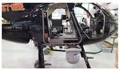
A Haverfield Aviation MD 500 helicopter is being outfitted with a Trakka Systems SWE-400 QUAD gimbal equipped with HDTV, IR, and UV video sensors for documenting multiple aspects of electric power transmission and distribution (T&D) line operating conditions. A high-resolution still photo camera is also available for capturing detailed oblique images of power line components and structures.
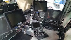
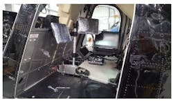
Also onboard the helicopter, a Remote GeoSystems 4-channel geoDVR and monitors will insure successful recording and real-time GPS-referencing of all three video cameras plus a switchable channel. Completing the package is the Remote GeoSystems suite of LineVision tools for rapid post-inspection video and photo reporting in a utility company’s existing GIS and computer aided design and drafting (CADD) systems.
Haverfield Aviation's team installed and integrated the geoDVR and Trakka camera on the helicopter itself. The Remote GeoSystems team is providing training on the geoDVR and post-flight LineVision reporting software.
Remote GeoSystems designs and builds professional-grade geospatial video recording systems and integrated geographic information systems (GIS) mapping software to enable regulatory compliance in professional energy corridor patrols and other grid and critical infrastructure inspection applications.
This enhanced inspections system is scheduled to go operational in early February.
Search the Aerospace & Defense Buyer's Guide
The go-to resource for Intelligent Aerospace technology news & information:
Covering key topics
Across all market segments
Subscribe to the free Intelligent Inbox e-newsletter
Subscribe to receive all the latest aerospace technology news & information, delivered directly to your e-mail inbox twice a week (Tuesdays and Thursdays). Sign upfor your free subscription to the Intelligent Inbox e-newsletter at http://www.intelligent-aerospace.com/subscribe.html.
Connect on social media
Keep pace with aerospace innovation and opportunities via your favorite social media channels. Connect with Intelligent Aerospace on Twitter (@IntelligentAero), LinkedIn,Google+, and Instagram.

Courtney E. Howard | Chief Editor, Intelligent Aerospace
Courtney enjoys writing about all things high-tech in PennWell’s burgeoning Aerospace and Defense Group, which encompasses Intelligent Aerospace and Military & Aerospace Electronics. She’s also a self-proclaimed social-media maven, mil-aero nerd, and avid avionics and space geek. Connect with Courtney at [email protected], @coho on Twitter, on LinkedIn, and on Google+.


