U.S. Air Force, Army, and Navy weather specialists are using enabling technologies like supercomputers to make detailed weather forecasts anywhere in the world to support deployed warfighters.
BY J.R. Wilson
The most powerful weapon of war, weather, has raised and toppled empires, destroyed invasion fleets, crushed armies, and changed world history, yet it neither was created nor controlled by generals, admirals, or governments.
There have been many failed attempts at weather modification - something China reportedly continues to pursue - but the best any military ever has been able to do, with limited success, is predict how weather will influence their forces.
Weather affects all types of military operations, but the specific needs of the U.S. Army, Navy, and Air Force differ substantially. While the Navy and Air Force have a growing need for accurate long-range global strategic weather forecasting - albeit emphasizing different domains of war - the Army is focused on accurate, real-time regional tactical weather forecasting. As a result, the three have developed separate and independent technologies and strategies, even as they share common elements.
Different weather aims
The Air Force provides all meteorological services to Army and Air Force operational forces; the Navy and Marine Corps have their own capabilities, although weather personnel from all four services attend the Air Force weather schoolhouse at Keesler Air Force Base, Miss.
Air Force and Navy personnel also man joint weather stations - one in Hawaii and another in Europe - providing warnings and advisories, hazardous weather bulletins, military weather forecasts for ground and air operations, and, when designated joint, naval operations as well.
Both stations are aligned to U.S. combatant commands. The European station covers European Command and Africa Command; the one in Hawaii covers Pacific Command. The Air Force also has a station at Shaw Air Force Base, S.C., covering Central Command; another at Davis-Monthan Air Force Base, Ariz., covers Southern Command.
"Our focus is on the Army, which means ground forces and very short time scales," says Pamela Clark, chief of the Army Research Laboratory Battlefield Environmental Division in Adelphi, Md. "So when we talk about global or regional, the Navy and Air Force work on a more global scale, and we use a lot of the products the Navy may produce in terms of models and long-term forecasting.
"We look more at nowcast, which is a short forecast, typically three to six hours," Clark continues. "We get global models from the Air Force and Navy as a starting point, but a lot can happen due to local effects; terrain areas can have a lot of influence on Army missions."
The Army's Battlefield Environ-ment Division studies environmental impacts on Army systems, and develops new atmospheric models that will work at the fine scales the Army needs. "So we're different from NOAA [the U.S. National Oceanic and Atmospheric Administration] and other weather forecasters because we are looking at these short scales and may be in areas where we don't have a lot of observational data, so models have to run with sometimes limited input," Clark says.
The Navy has little interest in weather on land, other than its potential effect on global conditions, ports, and harbors, concentrating instead on maritime surface and subsurface conditions. Increasing the length of future weather forecasts is equally important, since it takes so long for ships to reach their destinations or escape extreme storms. Deployed Marines also depend on relatively long weather forecasts. The duration of accurate weather forecasting influences tactical sensor support, and system development.
"If the Navy doesn't fund that work, nobody else will," points out Ronald Ferek, program officer of marine meteorology and space research in the Office of Naval Research in Arlington, Va.
"Our biggest initiative right now is the Earth System Prediction Capability [ESPC] program," Ferek says. "For many years, the Navy has run global and metascale regional, forecasts. Global is good out to about 10 days. Within that global framework, we run about 100 regional models that provide the details in a particular location at a finer resolution. The Navy runs more metascale regions than anyone else in the world; more than half involve atmospheric forcing [the transfer of momentum and heat flux from the atmosphere into the ocean] on ocean surface and subsurface, driving detailed ocean forecasts.
"Rather than global and metascale grid technologies, we now are working toward an ESPC, where the atmosphere, ocean, land, space and ice are coupled," Ferek continues. "Running separate models for each of those five subsystems is fairly inefficient because the physics interact. Coupling across the different domains and working toward variable or adaptive grid methods, instead of running global models to provide resolution to a regional model, is a more efficient way to do things."
Although also looking to increase range and accuracy, the Air Force's focus is on atmospheric conditions that impact air operations, from airbase takeoffs and landings to en-route, cruise-level to weather over the target, as well as support for some Army missions.
"A strategic global model provides a unified global weather forecast for the combined Air Force and Army mission sets," explains Ralph Stoffler, the Air Force's director of weather. Air Force experts run global weather models out of the 557th Weather Wing at Offutt Air Force Base, Neb. The model comes in gridded format with machine-to-machine interfaces and post-process output for specific mission sets.
"We run our models and forecasts based on what's important to the military mission set," Stoffler says. "Where civilian forecasts tend to look at hazards, temperatures, and convective activity, we look at what temperature does to deployed airmen, dust to aircraft, etc. - the military impacts. We also focus on the entire globe, where most civilian forecasts look at local or national weather."
Looking to the future, however, Air Force weather experts want to change the paradigm.
Supercomputers and sensors
"The number-one thing that has driven weather forecasting forward is improved supercomputing capabilities," Stoffler says. "Our ability to run high-resolution models in a very short time has been essential to that. Thirty years ago, our global model had a 60-kilometer resolution; now it is 17 kilometers and by the end of next year, I expect it to go down to 10 kilometers," Stoffler says. "Miniaturization is going to give us increased data availability from various parts of the world, leveraging cubesats and placing miniaturized sensors on all kinds of satellites rather than just dedicated weather satellites.
"We're also building small sensors to put across the battlespace, mounted on vehicles and using Iridium [satellite phone] technology to bring that data back," Stoffler continues. "By putting sensors on almost every deployed vehicle, we can really increase the amount of data we have to use. The technology is not yet there for us to put sensors on individual warfighters, but sensor development is moving ahead quickly and the real challenges are communications and cybersecurity."
The impact of those technology advances on weather forecasting in the past two decades has been huge across all the services, says Benjamin MacCall, chief of Army Research Lab's Atmospheric Modeling Branch in Adelphi, Md.
"For the global perspective, the technologies that enable embedded computing lead to much more cost efficiency - cooling, energy, etc.," MacCall says. "That reduces the barrier to entry of other types of commercial technology, so the Air Force can do global forecasting at unprecedented levels of detail in a cost-effective manner. Embedded computing means you have to tailor your algorithms to what you're running them on. Using GPUs [graphics processing units] for general-purpose calculations requires a rethinking of how the physics are calculated in weather models.
"Going into the future, we see these kinds of embedded computational platforms being able to provide quick, maybe limited, area detail of the environments around buildings, for example, for quick decision making," MacCall says.
"They won't be doing full weather forecasting, but how weather is impacting a specific area," MacCall adds. "There also will be a significant growth in available sensor data, including many more carried by the soldiers themselves. All that has to be networked and optimized, having that capability on mobile phones and UAVs so the data can be reduced to important kernels of information that can be sent to where it can be used for future Army decision-making and execution."
SWaP and artificial intelligence
Despite miniaturization, size, weight, and power consumption (SWaP) remains a major problem for expanding the number and locations of weather sensors. As those issues are addressed, the volume of data gathered increases exponentially, making it necessary for many future platforms to perform onboard, real-time data analysis and fusion to alleviate a growing problem of information overload. One answer gaining momentum as the enabling technologies advance is some degree of artificial intelligence (AI).
"In the old days, we could provide a limited amount of information, where today we can create thousands of products every day," says the Air Force's Stoffler. "Because we want to provide everything we can to the operations world, we're starting to overload them. The feedback is all they want to know is will weather be a problem or not. Eventually we will have to develop some sort of AI that will let the operator know just that."
The Navy's Ferek agrees, calling weather forecasting "one of the largest computational efforts in the world." He adds, however, that even the best forecasts possible with the most advanced technologies still will be subject to small variables that create uncertainty - and could result in vastly inaccurate weather predictions.
The sheer volume of weather data also means there is insufficient time to incorporate all of it in time for the next forecast. Assimilating that "lost" data to improve resolution and build more detail into weather models would require a 10-fold increase in computational resources. Anything more powerful, such as exoscale-computing, is still an open area of research.
"Weather covers scales from planetary to molecular, with one of the most important being the phase change of water in the atmosphere at the molecular scale," Ferek says. "It would be a little difficult to know the ideal resolution for capturing as many processes as possible, and at what scale. Typically, the more physics you capture, the more accurate your forecasts. We know exactly what to do with a 10-fold increase in computational capability; the real game is how many more processes do I need to represent and at what scale so our models can carry those parameters forward. At some point, you reach a limit of predictability, as chaos becomes part of the problem," he explains.
"We're also trying to develop ensemble systems, instead of single deterministic forecasts," Ferek continues. "You try to capture the uncertainty of the forecasts by running a whole bunch that are just slightly different from each other. Sometimes the atmosphere is quite unpredictable and the sensitivity to the forecast can be a very small difference in one variable; you want to bracket the range of possibilities so you have an ensemble where the many members are all equally likely. In a situation where the forecast is uncertain, a single deterministic forecast can be very wrong, but a range of forecasts can capture how much uncertainty you have."
Little reliance on civilian technology
Unlike the vast majority of technology advances that have changed the face of warfare, military global strategic and tactical weather forecasting have only minimal reliance on civilian meteorology.
"The commercial data available actually is pretty limited. We are working with them to increase that, but we tend to rely on data produced by the U.S. Department of Defense (DOD) or national [agencies] and international governments that make it available through the World Meteorological Organization weather exchange," the Air Force's Stoffler explains.
"Under international rules of engagement, each country is to exchange a certain amount of weather data to all others. There also is a secondary set of data unique to those countries and not exchanged. DOD maintains our own data in some areas and has treaties to share it with some allies, but we also have methods in place to cut that data off, if necessary."
The Army Communications- Electronics RD&E Center (CERDEC) Space and Terrestrial Communi- cations Directorate at Aberdeen Proving Ground, Md., performs modeling and simulation for the Army's tactical network. Starting with accurate and detailed models of what warfighters will be using in the battlefield, they look at the impact on the network of adding a new technology or removing an existing one, changing the location or distribution of certain network nodes and, where possible, incorporating weather impacts into the analysis.
"The more accurately we can describe the environment at a given location, the higher-fidelity answer we can give to our analysis and provide a better functioning network," says Joshua Fischer, chief of the data collection, analysis, modeling and simulation branch at CERDEC. "It all boils down to accuracy and fidelity - the more accurate inputs we have, the more accurate outputs we will have.
"Today, we are using the Terrain Integrated Rough Earth Model (TIREM) to predict median propagation loss from 1 MHZ to 40 GHz for the network, items such as tropospheric scatter, atmospheric absorption, deflection, refraction, etc.," Fischer says. "MODESTA [Modeling Emulation, Simulation Tool for Analysis] is our system-of-systems network modeling framework. It provides a large-scale, tactical network analysis environment with a centralized framework so analysts can conduct realistic, operational scenarios with emulated and simulated systems, all while accessing centralized data models and data collection, reduction, and analysis tools."
Microscale weather models
While the Navy and Air Force work on large models, the Army is focusing on the other end of the scale.
"We work on microscale model development, tailoring our program toward scales less than one kilometer and optimizing for urban environments, so we want to make sure we can detail flow fields within dense urban environments," the Army Research Lab's MacCall says. "We also look at mountainous terrain. Because of the high resolution, we don't do these models globally, but simulating over a smaller area, using coarser data to drive the boundary conditions, which we then use to figure out how the flow will be impacted by features such as buildings, mountains and hills. The main program is called the Atmospheric Boundary Layer Environment (ABLE) model development program. We began about four years ago, looking at complex terrain and urban areas."
ARL's in-house model developments are unique to the Army's short-scale time domain. The work MacCall's branch does at Adelphi is based in part on experimental data collected by ARL's Atmospheric Dynamics Branch (White Sands Missile Range, NM), looking at the lower two miles of the atmosphere.
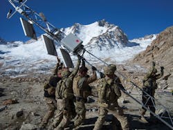
"A program we began almost two years ago is the Meteorological Sensor Array," MacCall says. "There are at least 36 towers in our initial array that will become operational by the end of summer 2017."
The Meteorological Sensor Array is located at the Jornada Experimental Range in Las Cruces, N.M. Partners include the Naval Research Laboratory in Washington, New Mexico State University, and the U.S. Department of Agriculture.
"After we characterize the atmosphere and build more accurate models as a result, the model output then is used as input to our tactical decision aids for weather, where we have developed a number of tools that give the soldier and commander a color-coded, stoplight-type output - green for good, yellow for marginal, red for unacceptable. That gives anyone an instant way the see the impact of weather on his operations," says Dave Knapp, acting chief of the Army Research Lab's White Sands Branch in New Mexico.
Arctic weather
The Navy is responsible for forecasting some of the most powerful and unique weather conditions on the planet - Atlantic hurricanes, Pacific typhoons, and one of the least-understood environments, now becoming critical - the Arctic, where they have a major initiative underway to improve forecasting. Ferek says current models miss half of the intense storms that are common to the region, and significantly misforecast the intensity level of those predicted.
While that makes U.S. Arctic weather forecasting the least accurate on the planet, he adds, all of the other Arctic nations also are deficient due to a combination of insufficient - or non-existent - observations and a lack of systematic study. A lot of Arctic modeling technologies are funded by the Navy, seeking to understand how wind waves and swell effect the state of the ice, for example.
"The physics are different up there; the resolution of the models is too coarse," Ferek says. "Imagine if half the tropical cyclones were unpredicted; it would be a disaster. The meteorological community has ignored the Arctic for too long. We've done fairly well at getting the tropics correct, but haven't spent anywhere near as much on the Arctic. A lot of errors in our global forecasts actually originate in the Arctic."
The Pacific also offers unique challenges for the Navy, which places a big emphasis on remote sensing. Similar in many ways to the National Hurricane Center for the Atlantic, the Joint Typhoon Warning Center covers the Western Pacific. Unlike the Atlantic, however, there is little to no reconnaissance in the vast open waters of the Pacific, forcing the Navy to rely on remote sensing and using all available sources - primarily commercial satellites - to get an idea of the size, extent, intensity, and track of storms.
Remote sensing
These large- and small-scale efforts are not entirely separate, but can be pulled together to create a more complete view of weather patterns across the globe, at all levels.
"A lot of global phenomenon start at small scales and graduate upscale," Ferek says. "If you start with a global model to provide interaction to the regional model, it only goes one way.
"Something with a unified global/regional variable grid technology can interact upscale and downscale, which is more accurate for some of the things we deal with," Ferek explains. "That means capturing the small scales and aggregating the effect up to large scale. That is mostly still in 6-2 applied research, although the basic framework is in 6-3 advanced technology development. The upscale effort is still in 6-1 [basic research].
"We hope to show it is feasible and can be operated within the restraints of the operating capability we have by 2020, showing we can link the systems and develop the models," Ferek says. "If we find our models can't capture reality, then we will have to go back to the drawing board to see what basic physics we're missing. One of the major technological problems is just building the framework where ocean, land, ice, atmosphere, and space models can all interact in a coupled system. That requires a lot of software engineering."
Weather, war, and world history
Nearly 5,000 years ago, dramatic regional climate change turned the lush green expanse of North Africa into the Sahara Desert. That, in turn, forced the largely nomadic tribes of the area toward the only remaining source of food and fresh water - the Nile River. As their numbers grew, these weather-driven peoples eventually created the Egyptian Old Kingdom.
Half a millennium later, however, another major shift in the weather, which prevented the annual flooding of the Nile, brought the Egyptian Old Kingdom to an end. Another shift less than 150 years later gave rise to the Egyptian Middle Kingdom.
In the 13th Century, Mongol ruler Kubla Khan sent two massive fleets - the first in 1274 of 500 to 900 ships and 40,000 men, the second (seven years later) with 4,400 vessels and 140,000 men - to invade Japan. Both fleets were destroyed by massive typhoons. Although they created the largest contiguous land empire in history, the Mongols never again attempted to cross large bodies of water. The Japanese commemorated the 1281 typhoon as the "divine wind" - or Kamikaze.
In May 1588, a Spanish Armada of more than 130 ships carrying some 30,000 men set sail to invade England. It was Spain's second attempt, the first, a few weeks earlier, having been forced back by storms in the English Channel.
The second Spanish attack on England faced a valiant defense - including fire ships that caused more confusion than damage delayed the Armada and caused it to break formation and course. The final blow, however, came from what has been described as one of the worst storms in English history. As Spanish King Felipe II later told the survivors, "I sent you out to war with men, not with the wind and waves."
In late June 1812, French Emperor Napoleon Bonaparte sent an army of 610,000 men into Russia, expecting to force a quick Russian surrender. But Czar Alexander's army instead conducted a months-long "scorched Earth" retreat to Moscow, which they also abandoned - after setting it ablaze. By October, with their army reduced to only 100,000 by death, illness, and desertion, an unusually early and harsh Russian winter fell upon them, causing the French to begin a retreat that would destroy most of what was left of the Grande Armée.
Adolf Hitler's vaunted Wehrmacht met a similar fate 130 years later, when the severe Russian winter once again came to the defense of Moscow and the then-Soviet Union.
Two years later, on 6 June 1944, weather over the English Channel worked in favor of the largest amphibious invasion in history - some 5,000 vessels carrying more than 160,000 Allied troops to Normandy. Despite an estimated 10,000 casualties, the Allies seized a foothold in France that helped end the European half of the deadliest war in history 10 months later. The invasion had been postponed one day by bad weather, which threatened to stop what the Nazis could not. But clear weather the following day made success possible.


