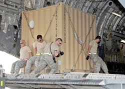
Air Force seeks help in boosting air logistics capability with machine learning and sensor integration
ROME, N.Y. – U.S. Air Force researchers are asking for industry help to apply machine learning and sensor integration to military air logistics, sustainment, and resupply.
Officials of the Air Force Research Laboratory Information Directorate in Rome, N.Y., issued a broad agency announcement (FA8750-20-S-7005) last week for the Digitally Optimized Geospatial and Tactical Airfield Guide (DOGTAG) program.
DOGTAG focuses on developing and applying machine learning, asset tracking, process digitization, long term evolution (LTE), sensor integration, and related technical capabilities to air and ground transportation -- especially to port operations, contingency response, and aerial delivery.
Little research has explored how technologies like machine learning, asset tracking, process digitization, long term evolution (LTE), and sensor integration could benefit tactical air and ground transportation, Air Force researchers point out.
Related: Artificial intelligence and machine learning for unmanned vehicles
Military operating conditions amplify the need for optimized work flows, as well as augmented collaboration tools. DOGTAG seeks to develop new capabilities in machine learning-based object and hazard detection, data federation, and refining aerial delivery that could transform how the U.S. military communicates, collaborates, organizes, and operates in air logistics operations.
The Air Force faces tremendous demands to meet the needs of rapid global mobility, researchers say. There is room to capitalize on technology for increased efficiency by adapting and scaling operations, and reducing manual labor.
This work is necessary to enable logistics authorities to support the Air Force Agile Combat Employment (ACE), which requires extremely agile logistics in airport operations; contingency response; and aerial delivery.
Each of these areas focus on moving cargo in three environments: strategic and en route (airport); austere and degraded (contingency response), and airborne (aerial delivery).
The Android Team Awareness Kit (ATAK) is government-off-the-shelf software for Air Force mobile devices, and Air Force researchers would like to expand on ATAK-based tools.
DOGTAG aims to track cargo in real time, optimize pallet loading, and consolidating existing Air Force mobility databases into one interface. It also seeks to develop an infrastructure for low cost, secure, and beyond-line-of-sight tracking of sensitive and important cargo that has at least two months of battery life; is small and of equal performance than today's radio frequency identification (RFID) tags; costs less than $20 per ;month; and is available in at least 175 countries.
The project also seeks to develop automated algorithms for efficient cargo palletizing, with a 10-to-30-percent reduction in monthly pallet build time; an increase in cargo movement efficiency by 7 percent over 30 days; as well as fuel reduction, increased plane availability or re-assignment.
In addition, the project seeks to build a centralized querying framework for existing Air Force databases, including Global Air Transportation Execution System (GATES), GO81 System, Integrated Maintenance Data System (IMDS), and Global Decision Support System version 2 (GDSS2) to provide one point of reference for where aircraft are located, landing times, cargo onboard, and maintenance data.
Related: DARPA funding brings machine learning to BAE Systems’ Signals Intelligence capabilities
This framework should have a 100 percent increase in mobile accessibility to legacy databases; should be accessible via mobile web browser; should have a 50 percent increase in mobile accessibility to data from legacy databases; should have enabled access via Air Force logistics servers; should have a 20 percent reduction in database data errors; and have secure authority to operate.
DOGTAG also seeks to improve operations from austere aerial ports by reducing the time of average joint inspection process by two hours; offering a 47 percent increase in automation and validation of the shipper’s declaration of dangerous goods; and offer a 15 percent increase in the accuracy of vehicle and asset inspections.
The project seeks the ability to assign jobs to unmanned aircraft via mobile devices to survey an area and confer 3D models into runway survey planning documents. This should offer a 50 percent reduction in surveying time; and a 27 percent reduction in exposure of personnel to hazardous environments.
Related: Top technology challenges this decade for the warfighter
DOGTAG seeks to use machine learning for runway survey and hazard detection by classifying runway hazards and runway damage assessment> It should offer 80 percent accuracy in detecting roaming animals and birds; an 85 percent accuracy detecting lost tools; and a 90 percent accuracy in detecting runway cracks, holes, and large debris; should conduct a full runway scan in 30 minutes or less; and offer no more than 10 percent false negatives.
Companies interested should email unclassified three-to-five-page white papers no later than 30 Sept. 2022 to the Air Force's Matthew Paulini at [email protected].
Email technical questions to Matthew Paulini at [email protected], and contracting questions to Amber Buckley at [email protected].
More information is online at https://sam.gov/opp/ffd52e50eb4244dfb7c04ae4ee86ee82/view.

John Keller | Editor-in-Chief
John Keller is the Editor-in-Chief, Military & Aerospace Electronics Magazine--provides extensive coverage and analysis of enabling electronics and optoelectronic technologies in military, space and commercial aviation applications. John has been a member of the Military & Aerospace Electronics staff since 1989 and chief editor since 1995.

