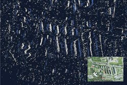
GPS-alternative tech swaps satellites for Earth fingerprints
SYDNEY, Australia - Even though most of today's aircraft rely heavily on GPS for navigation, the technology is far from infallible. That's why an alternative system is in the works, which may soon allow planes to navigate by "reading the fingerprint" of the terrain they're flying over, Ben Coxworth writes for New Atlas. Continue reading original article.
The Military & Aerospace Electronics take:
12 December 2024 - Australian navigation and autonomous systems company Advanced Navigation and European missile systems company MBDA - a joint venture of Airbus, Leonardo, and BAE Systems - are developing a way for aircraft to use neuromorphic sensors for match terrain "fingerprints" to place itself.
"The final solution is set to enable systems, such as uncrewed air systems (UAS), to secure an absolute position fix over land with a solution that is passive and resistant to interference," the companies say. "The technology will enhance the safety of beyond visual line of sight (BVLOS) operations, as the solution overcomes many of the conventional limitations of airborne image-based navigation technologies.
Related: GPS jamming amid wars playing havoc with airline navigation – report
Related: Shift5 introduces GPS integrity module to combat GPS spoofing risks
Jamie Whitney, Senior Editor
Military + Aerospace Electronics
